🛶 Before Roads, There Were Rivers 💧 A Map of River Cities 🗺️🏙️
🌊 A follow-up story from The Work of Water chapter in the Geography Album, flowing naturally to the chapter Ecology in the Biology album. This story reveals how rivers shaped the cities we know today. Children explore a special map marked with red dots—each one showing a city that grew beside a river. From London on the Thames to Timbuktu on the Niger, rivers once carried boats, food, trade, and people long before roads existed. 🌍🛶 This story invites children to notice the rivers in the cities they explore by foot and get inspired to investigate further “What cities in my country were born by rivers?” “Do always people settle near water?” It also opens up space for deeper reflection and care: 💧 🌱“How do we protect the water in the rivers that gives life to so many plants, animals, and communities?”
GEOGRAPHY STORIES
10/1/20255 min read
“Follow me,” said the River. 🌊💬
“I will bring you water. I will carry you far. I will help your seeds grow, and your dreams too.”
Before cars, before trains, before even roads—our ancestors followed the rivers.
Why? Because the river gave fresh water to drink, fed their crops and turned dry dust into golden fields. 🌾 It gave them fish, shade, and cool breezes on hot days. It offered a way to move—by canoe, raft, or boat. And so, wherever the river flowed, the people stayed.
They built homes, then villages, then towns… and finally, great cities!🏘️➡️🏙️
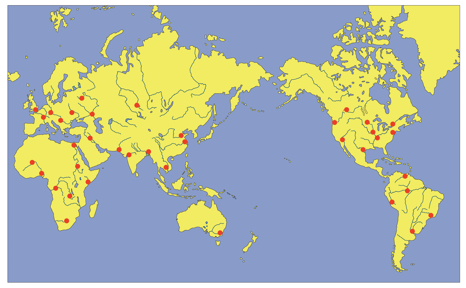
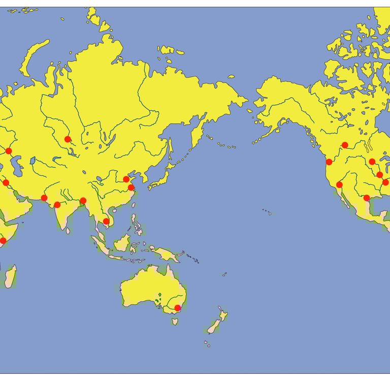
🗺️ Today I brought you another map. But it’s not just any map—it’s a map marked with red dots. 📜 You have seen similar map before, showing the great rivers around the world. On this map each red dot marks a city that grew beside a river. Let’s visit a few together, and imagine what life was like, long ago, when rivers were the only highways
Here is Montreal 🇨🇦 This wide river is St. Lawrence River , it served as a gateway into a vast new world. Indigenous peoples paddled canoes through the forests, fishing and trading along its banks. Then came explorers from Europe, following the river inland. Montreal became a city of fur traders, merchants, and ships. Even today, enormous ships pass through the St. Lawrence Seaway, connecting the Great Lakes to the Atlantic Ocean. 🚢❄️
Let’s stand on the riverbank in the heart of America, where the mighty Missouri River meets the Mississippi—and there, we find St. Louis. 200 years ago, before highways or airplanes, this very spot was the doorway to the wild unknown. Explorers like Lewis and Clark set off from here in 1804, following the Missouri River on a bold journey across the continent. That’s why St. Louis is called the Gateway to the West—because this is where adventure began. ⛵🧭 Fur traders and farmers, musicians and inventors—all passed through this riverside city. And rising above them, like a silver sunrise, stands the famous Gateway Arch, reminding us of the courage it took to follow the river westward. 🌄🌉
Now let's follow the Yangtze River, the longest river in Asia, all the way to the sea—and there we find Shanghai.Shanghai began as a small fishing village on the Yangtze Delta, where the river meets the ocean. But this was no ordinary river mouth—this was the “mouth of the dragon”, full of trade. 🐉⚓ Soon, ships came from everywhere—India, Arabia, Europe—bringing spices, silk, and secrets. Shanghai grew into a glittering city of trade and towers, with lantern-lit streets and stories from every corner of the world.
High in Asia, where winters are long and snow covers the earth, the Ob River flows quietly through the land.And along this river sits Novosibirsk, a city that rose from icy forests thanks to a railroad and a river. ❄️🚂🚢 Before there were roads across Siberia, the river was everything. It brought logs for building, fish for dinner, and coal to keep warm. And even now, when snow covers the tracks and the roads, the river keeps moving— frozen or flowing, busy highway. If you look at a map, you’ll see something special: almost every town in Siberia is next to a river. That’s because rivers were—and still are—the veins of the land, bringing life to even the coldest places.
No roads? No problem. The Amazon River was and still is the road through the jungle! Indigenous people have traveled this river for thousands of years. Then came the Rubber Boom — and Manaus was born. Located in the heart of Amazon River, this jungle city grew into a bustling port, floating with canoes, steamers, and cargo boats. The river carried rubber, cocoa, fish, and forest treasures from the center of Amazon river to every corner of the world.🌳🛶
🏜️ In the middle of the wide, dry Sahara Desert, there’s a river which weaves like a ribbon of life through the dry dunes. This is Niger River and right near a bend in this great river, people set up a markett 🛶💰a simple resting spot for traders bringing salt from the desert and gold from the south. That little market grew into a village… and then into something amazing. Timbuktu became one of the most important trading cities in the world.🌍Traders from faraway places came here to buy and sell goods. 🐪📦 People built schools, libraries, and universities, 🏫 📚where students studied math, science, medicine, and even the stars. 🌌🔬🎓 The Niger River acted like a highway, carrying boats full of goods and people, the reason Timbuktu bloomed in the middle of the desert like a golden flower. 🌼
Let’s travel now to Europe—where castles rise on hilltops and rivers that curl through ancient towns. 🏰✨ In England, there’s a famous river called the Thames River , and beside it stands the big, bustling city of London! 🇬🇧A loooong time ago—nearly 2,000 years ago!—the Romans came here and built a bridge across the Thames and started a settlement called Londinium. The Thames was like a watery highway—deep enough for ships, winding gently through green hills, and perfect for trade. Roman boats carried wine, wool, grain, and shiny glass treasures. 🍷🧶🪞
And even after the Romans left, London kept growing. People used Thames to transport coal to warm their homes and stones to build towers. From the port of London, explorers set sail on grand adventures, bringing back tea, spices, silk, and stories from faraway lands. 🍵🌶️🌍 The river has seen kings in golden boats, queens in sparkling gowns, parades with music, and even battles on its waters!💂♀️🚢👑
Look at this map, every great city has a river at its heart. The river brought people life—water, food, and connection. It was their road before roads, their path before pavements.💧
🌍 Wherever you go, look closely…in almost every city you’ll find a river that helped it grow.
🌊 I wonder… Which red dot on the map will you explore next? What river flows nearby, and how did it help that city grow—was it used for travel, for trade, for drinking or farming? And what about today? Do people still use the river?
🇺🇸Bonus Addition for My U.S. Friends — The River That Turned Around!
Let’s head back north, to the Great Lakes… to a city called Chicago. Here, the river’s story is surprisingly amazing—almost like a fable! Chicago grew on the Chicago River. And for many years, that river flowed into Lake Michigan, bringing with it pollution from the city. People were getting sick because their drinking water came from the same lake.🚱💧 Something had to be done.
So what did they do? They reversed the river. 😲🚧 Yes, a little over 120 years ago, in the year 1900, engineers built a huge canal— the Chicago Sanitary and Ship Canal — and made the river flow backward, away from the lake and toward the Mississippi River system. This massive project was so famous, it’s considered one of the greatest engineering feats of its time. 🏗️💡 The river also helped Chicago grow into one of the busiest trade cities in the world — a direct connection between the Great Lakes and the Mississippi River and the Gulf of Mexico.
Imagine people telling a river: “Sorry, you’re going the wrong way!” and making it turn around! 🌀Sounds like a fable, but it is a true story! 💭 I wonder… have other rivers been changed or redirected by humans? Why do we do it? And what happens when we do?
🔍 Possible Follow-Up Explorations
🗺️ Find the Cities on the Map
Use a globe, atlas, or digital map to locate the red dots marked on your chart. Can you find out which rivers they sit beside?
📚 Research Project
Choose one city and its river. How did the river help it grow? What did people trade? What made that river important? Is it still important?
🏛️ Local Connections
What rivers are near your home? Are there towns or cities built nearby? Do they have special stories to tell?
🧩 Build a River & City Map
Recreate the river map with clay, paper, or cardboard. Add red dots for cities, and label them.
With Montessori joy,
Vanina 😊